File:Prydon Atlas Map.png: Difference between revisions
Jump to navigation
Jump to search
No edit summary |
(Rivers uploaded a new version of File:Prydon Atlas Map.png) |
Latest revision as of 03:09, 28 April 2024
Topographic map of Prydon.
File history
Click on a date/time to view the file as it appeared at that time.
| Date/Time | Thumbnail | Dimensions | User | Comment | |
|---|---|---|---|---|---|
| current | 03:09, 28 April 2024 | 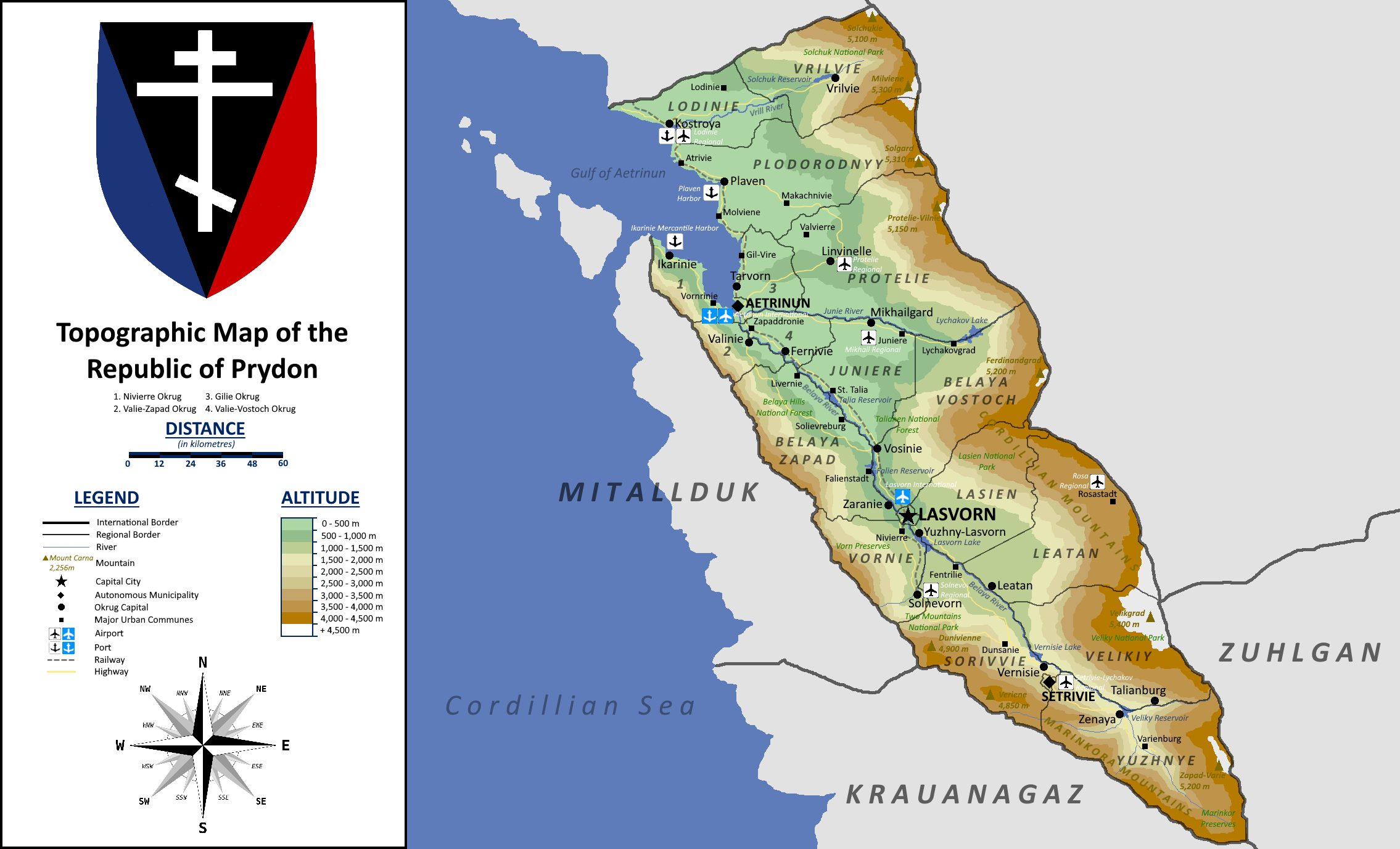 | 2,270 × 1,377 (452 KB) | Rivers (talk | contribs) | |
| 03:01, 28 April 2024 |  | 2,270 × 1,377 (452 KB) | Rivers (talk | contribs) |
You cannot overwrite this file.
File usage
The following page uses this file: