File:Ancient alcoalitania map.png

Size of this preview: 600 × 600 pixels. Other resolutions: 240 × 240 pixels | 480 × 480 pixels | 1,000 × 1,000 pixels.
Original file (1,000 × 1,000 pixels, file size: 58 KB, MIME type: image/png)
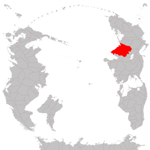
Map of the Ancient Alcoalitanian Empire (with provinces)
File history
Click on a date/time to view the file as it appeared at that time.
| Date/Time | Thumbnail | Dimensions | User | Comment | |
|---|---|---|---|---|---|
| current | 16:29, 26 June 2024 | | 1,000 × 1,000 (58 KB) | Xshotss (talk | contribs) | |
| 16:25, 26 June 2024 |  | 10,667 × 10,667 (747 KB) | Xshotss (talk | contribs) | ||
| 13:26, 14 May 2024 |  | 300 × 207 (18 KB) | Xshotss (talk | contribs) |
You cannot overwrite this file.
File usage
The following page uses this file: