File:Gov isl map.png
Jump to navigation
Jump to search

Size of this preview: 600 × 600 pixels. Other resolutions: 240 × 240 pixels | 480 × 480 pixels | 768 × 768 pixels | 1,024 × 1,024 pixels | 2,048 × 2,048 pixels | 2,656 × 2,656 pixels.
Original file (2,656 × 2,656 pixels, file size: 866 KB, MIME type: image/png)
File history
Click on a date/time to view the file as it appeared at that time.
| Date/Time | Thumbnail | Dimensions | User | Comment | |
|---|---|---|---|---|---|
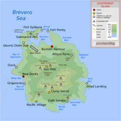
| current | 20:14, 27 July 2022 | | 2,656 × 2,656 (866 KB) | Qwert (talk | contribs) | Added Fort Syldavia |
| 15:30, 21 January 2021 | 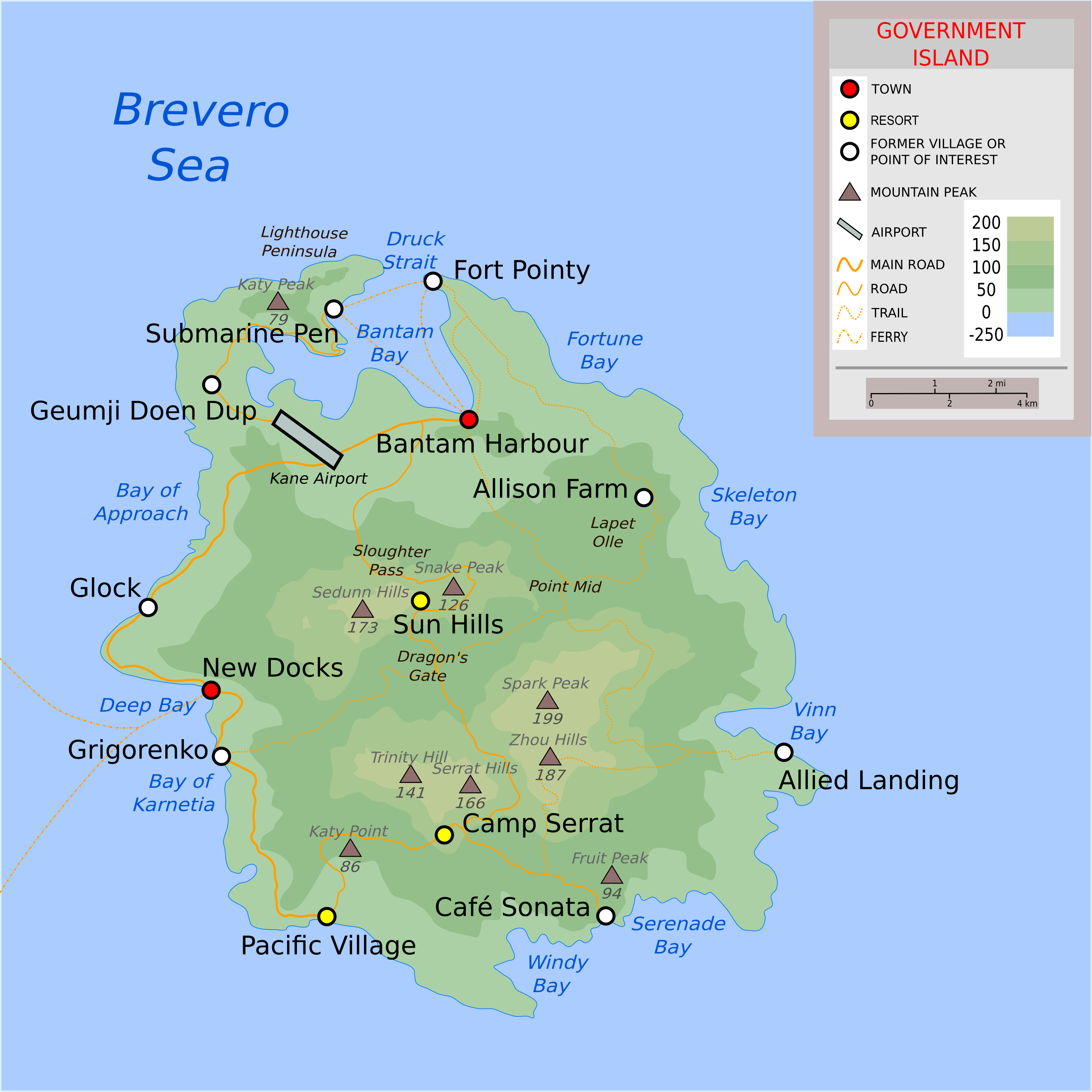 | 2,656 × 2,656 (855 KB) | Rabbitz (talk | contribs) |
You cannot overwrite this file.
File usage
The following page uses this file: