Kustannuksan Empire (Pacifica): Difference between revisions
Jump to navigation
Jump to search
No edit summary |
No edit summary |
||
| Line 79: | Line 79: | ||
|area_label2 = <!--Label below area_label (optional)--> | |area_label2 = <!--Label below area_label (optional)--> | ||
|area_data2 = <!--Text after area_label2 (optional)--> | |area_data2 = <!--Text after area_label2 (optional)--> | ||
|population_estimate = | |population_estimate = 104.893.807 | ||
|population_estimate_rank = | |population_estimate_rank = | ||
|population_estimate_year = 2023 | |population_estimate_year = 2023 | ||
|population_census = | |population_census = | ||
|population_census_year = 2023 | |population_census_year = 2023 | ||
|population_density_km2 = | |population_density_km2 = 201.3 | ||
|population_density_sq_mi = | |population_density_sq_mi = | ||
|population_density_rank = | |population_density_rank = | ||
Revision as of 11:20, 28 January 2024
Kustannuksan Empire Kustannuksalainen Imperiumi | |
|---|---|
Motto: "Suuruus seuraa Pohjoistä Tähteä" "Greatness follows the Northern Star" | |
Anthem: "A Star shines over the Seas" Royal anthem: "A beacon of light to follow" | |
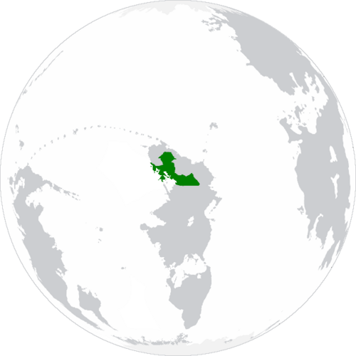
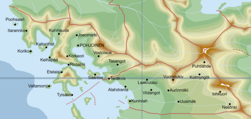
 Territories of the Kustannuksan Empire. | |
 | |
| Location | Location Of Kustannuksa in the north of Bailtem. |
| Capital and | Pohjoinen 2°25'N 25°69'E |
| Official languages | Kustannuksan |
| Ethnic groups | Kustannuksan |
| Demonym(s) | Kustannuksan |
| Government | Federal Parliamentary Constitutional Monarchy |
| Legislature | Imperial Parliament |
| Imperial Senate | |
| Imperial Chamber Of Deputies | |
| Area | |
• | 521,082 km2 (201,191 sq mi) |
| Population | |
• 2023 estimate | 104.893.807 |
• Density | 201.3/km2 (521.4/sq mi) |
| Gini | 21.6 low |
| HDI | 0.968 very high |
| Currency | Kustannuksan Tähtirah (TAH) |
| Time zone | UTC+2 (UTC) |
| Date format | dd/mm/yyyy CE |
| Driving side | right |
| Calling code | +150 |
| World Forum Code | KU |
| Internet TLD | .ku |
Kustannuksa, officially named the Kustannuksan Empire (In Kustan: Kustannuksalainen Imperiumi), in a sovereign confederation of states located in the north of Bailtem.

