File:Besern map world.png
Jump to navigation
Jump to search

Size of this preview: 600 × 600 pixels. Other resolutions: 240 × 240 pixels | 480 × 480 pixels | 768 × 768 pixels | 1,024 × 1,024 pixels | 2,488 × 2,488 pixels.
Original file (2,488 × 2,488 pixels, file size: 319 KB, MIME type: image/png)
Summary
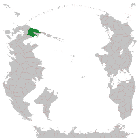
Map of Besern in the South Pacific
File history
Click on a date/time to view the file as it appeared at that time.
| Date/Time | Thumbnail | Dimensions | User | Comment | |
|---|---|---|---|---|---|
| current | 06:53, 13 February 2022 | | 2,488 × 2,488 (319 KB) | Besern (talk | contribs) | Reverted to version as of 11:36, 31 July 2021 (UTC) |
| 06:52, 13 February 2022 | 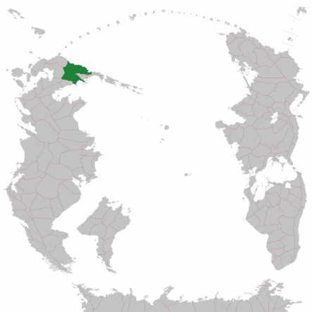 | 443 × 443 (112 KB) | Besern (talk | contribs) | made smaller | |
| 11:36, 31 July 2021 |  | 2,488 × 2,488 (319 KB) | Besern (talk | contribs) | ||
| 11:34, 31 July 2021 |  | 5,750 × 5,750 (623 KB) | Besern (talk | contribs) | Map of Besern in the South Pacific |
You cannot overwrite this file.
File usage
The following page uses this file: